
The Earth in HD
The best data collecting available
The trio of WorldView satellites built for DigitalGlobe, now part of Maxar, capture high-resolution Earth imagery that support a wide variety of uses, including civil government mapping, land-use planning, disaster relief, exploration, defense and intelligence, visualization and simulation environments, and navigation technology such as Google Maps. The satellites offer the best high-resolution imagery data gathering capability available today.
Worldview-3
Dowload this PDF to learn more about the WorldView-3 mission.
DOWNLOAD
File Type:
PDF
File Size:
2.74mb
Worldview-3 Infographic
Dowload this infographic for an overview of WorldView-3's specifications.
DOWNLOAD
File Type:
PDF
File Size:
1.19mb
Worldview-2
Download this PDF to learn more about the WorldView-2 mission.
DOWNLOAD
File Type:
PDF
File Size:
3.46mb
Worldview-3
Our role: spacecraft & instrument provider, integration & test lead
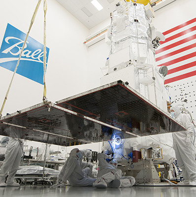
WorldView-3 was launched in August 2014 and provides 31-centimeter resolution panchromatic and 1.24-meter resolution eight-band multispectral imagery making it the highest resolution imagery commercially available. The satellite’s technology allows it to see beyond the visible spectrum into the infrared, providing a rich dataset for precisely identifying manmade and natural materials. It operates at an altitude of 617 kilometers (383.3 miles), has an average revisit time of less than one day, and can image 680,000 square kilometers of the Earth every day.
We built the BCP-5000 spacecraft bus for WorldView-3 with the ability to handle next-generation optical and synthetic aperture radar remote-sensing payloads. We also built the Cloud, Aerosol, Water Vapor, Ice, Snow (CAVIS) atmospheric instrument, the first atmospheric sounder DigitalGlobe has flown in space. CAVIS enables WorldView-3 to collect imagery even through clouds or snow.
We built the BCP-5000 spacecraft bus for WorldView-3 with the ability to handle next-generation optical and synthetic aperture radar remote-sensing payloads. We also built the Cloud, Aerosol, Water Vapor, Ice, Snow (CAVIS) atmospheric instrument, the first atmospheric sounder DigitalGlobe has flown in space. CAVIS enables WorldView-3 to collect imagery even through clouds or snow.
Worldview-2
Our role: spacecraft provider, integration & test lead
WorldView-2 was launched in October 2009 to continue DigitalGlobe’s goal to provide unparalleled imaging capability for an eight-year planned mission. WV-2 was the first high-resolution 8-band multispectral commercial satellite and operates from an altitude of 770 kilometers with an average revisit time of 1.1 days. WorldView-2 has the ability for direct tasking, which allows select DigitalGlobe customers around the world to load imaging profiles directly up to the spacecraft and execute delivery of the data directly down to their own ground systems.
We built the BCP-5000 spacecraft bus for WorldView-2, demonstrating the bus’s ability to be a flexible, stable and highly accurate Earth remote sensing platform. Additionally, we integrated the remote sensing instrument and tested the entire system. Our engineers also equipped WorldView-2 with an instrument vibration isolation system for controlling jitter.
We built the BCP-5000 spacecraft bus for WorldView-2, demonstrating the bus’s ability to be a flexible, stable and highly accurate Earth remote sensing platform. Additionally, we integrated the remote sensing instrument and tested the entire system. Our engineers also equipped WorldView-2 with an instrument vibration isolation system for controlling jitter.
Worldview-1
Our role: spacecraft & instrument provider
Launched in September 2007, WorldView-1 represented a new commercial standard in rapid targeting, image resolution and data handling that has improved with each WorldView satellite since. WorldView-1 images demonstrate the spacecraft’s precise geo-location capabilities and extreme stability.
We built the BCP-5000 spacecraft bus and the WorldView 60 camera for the mission. It collects up to 500,000 square kilometers (200,000 square miles) of half-meter imagery per day, operates at an altitude of 496 kilometers, and has a revisit time of 1.7 days. It supports DigitalGlobe’s NextView contract from the National Geospatial-Intelligence Agency and commercial customers around the world.
We built the BCP-5000 spacecraft bus and the WorldView 60 camera for the mission. It collects up to 500,000 square kilometers (200,000 square miles) of half-meter imagery per day, operates at an altitude of 496 kilometers, and has a revisit time of 1.7 days. It supports DigitalGlobe’s NextView contract from the National Geospatial-Intelligence Agency and commercial customers around the world.
Satellites
Our line of customizable spacecraft provides reliable rides for small to large missions.
Instruments & Sensors
Delivering accurate data from all platforms in space, on land, in the air and at sea.