Landsat
Understanding Earth from Space
Every day since 1972, Landsat satellites have provided essential measurements to help the Nation make informed decisions about natural resource management, including compiling routine drought assessments; developing wildfire prevention strategies; monitoring land surface changes; evaluating agricultural production; and understanding the Earth’s ecosystem.
The Landsat program represents one of the most powerful and successful partnerships between government and private industry, yielding unparalleled scientific data for researchers and decision makers around the globe.
Each generation of Landsat satellites continues to advance the program’s historic data record. Ball is partnering with NASA, the U.S. Geological Survey and the science community to develop and demonstrate a future Landsat architecture that maintains data integrity, while enabling a more flexible and sustainable approach to land imaging missions.
NASA Landsat
USGS Landsat

What We Did
Instrument Provider
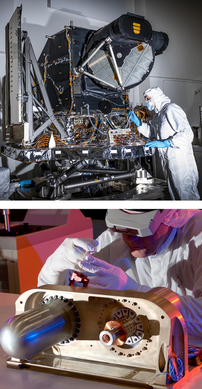
Ball designed and built the Operational Land Imager (OLI) on Landsat 8, which has demonstrated successful performance and exquisite calibration on orbit since its launch in 2013, enabling new coastal and inland water science. In 2019, Ball delivered a second OLI (OLI-2) instrument for Landsat 9 on schedule and under budget, achieving significant cost savings. Landsat 9 launched September 27, 2021.
In addition to OLI and OLI-2, we made the Thermal Infrared Sensor (TIRS) cryocoolers for Landsat 8 and Landsat 9. The cryocooler chills the TIRS instruments' infrared photo detectors to a frigid 40K.
The instruments on Landsat satellites have evolved significantly over the years, with the Operational Land Imager 2 on Landsat 9 representing the most advanced technology launched to date.
Ball Aerospace Landsat Team
Hear from some of the Ball Aerospace team members who are proud to have played a role on Landsat 9, whether on the Operational Land Imager 2 (OLI-2) or the cryocooler for the Thermal Infrared Sensor 2 (TIRS-2).

Next Steps
Sustainable Land Imaging
As a partner on the Sustainable Land Imaging-Technology (SLI-T) program, Ball has developed and flown innovative airborne instruments that demonstrate paths for potential next-generation Landsat architectures. These instruments have proven that both high performance multispectral and hyperspectral instruments can be built with significantly reduced size and cost.
NASA’s Earth Science Technology Office (ESTO) selected two Ball proposals for development and demonstration, with final airborne science flights for the two instruments successfully completed in 2020. The Compact Hyperspectral Prism Spectrometer (CHPS) and the Reduced Envelope Multi-Spectral Imager (REMI) programs aim to maintain continuity of the Landsat data record and provide flexibility for new technology insertion while reducing program costs.
On the heels of those airborne science flights, NASA selected Ball Aerospace to move forward with three additional studies to develop and demonstrate future Sustainable Land Imaging technologies beyond Landsat Next. The three studies include: Landsat Calibration Satellite (LCS), TransCal and Reduced Envelope Multispectral Infrared Radiometer (REMIR). These studies reflect the importance of continued advancement and the development of creative solutions. We are pushing the boundaries of what's possible when it comes to innovating robust, precisely-calibrated sensors in increasingly compact packages.
Sustainable Land Imaging
Mission-level solutions for Landsat Next and Landsat Beyond.
