
Clouds & Climate
3-D models
CALIPSO (Cloud-Aerosol LIDAR and Infrared Pathfinder Satellite Observations) is a mission dedicated to studying how clouds and aerosols impact the Earth’s climate. Scientists are using data from CALIPSO to construct 3D models of the atmosphere that improve our ability to predict future climate change. CALIPSO's LIDAR can also be used to measure particles below the ocean surface, including phytoplankton.
CALIPSO has been part of a constellation of spacecraft called the "A-Train," including Aqua, Aura and PARASOL spacecraft, dedicated to studying the Earth’s weather and environment. Part of a joint U.S. (NASA) and French (Centre National d’Etudes Spatiales (CNES) satellite mission, CALIPSO launched with Ball-built CloudSat on April 28, 2006 from Vandenberg Air Force Base. In 2018, CALIPSO and Cloudsat left the A-Train and were lowered about 10 miles into their own “C-Train.” The two satellites have resumed working and are delivering collocated measurements.
CloudSat
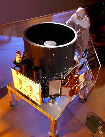
NASA CALIPSO
What We Did
Instrument & communications provider, payload integrator
We built the LIDAR (Light Detection and Ranging) and wide-field camera instruments, the communications equipment, and integrated the payload. The LIDAR scans the atmosphere with green and infrared laser light and detects backscatter from clouds and aerosols. The wide-field visible light camera and a three-color infrared imaging radiometer are part of the payload system and record additional information about clouds and aerosols.
Originally designed for a program life of three years, CALIPSO has traveled more than 2.4 billion miles, orbited the Earth 66,000 times, and has produced more than 18.5 terabytes of data in nine years on orbit. The CALIPSO LIDAR instrument registered firing over 5 billion laser shots on its redundant laser. The primary laser fired 1.6 billion shots before it was shut down. More than 2,220 peer-reviewed scientific papers have been written based on CALIPSO data.
Both CALIPSO and CloudSat were built on cost-capped budgets for NASA’s Earth System Science Pathfinder Program and have delivered high value science far exceeding mission design life. In 2007, a year after launch, our CALIPSO team received a Group Achievement Award from NASA.